
 |
| This 1922 photo shows the Duwamish River transforming into the Duwamish Waterway. The Smith Tower is in the distant upper right and a young Harbor Island can be seen at the end of the channel. File photo / The Seattle Times. |
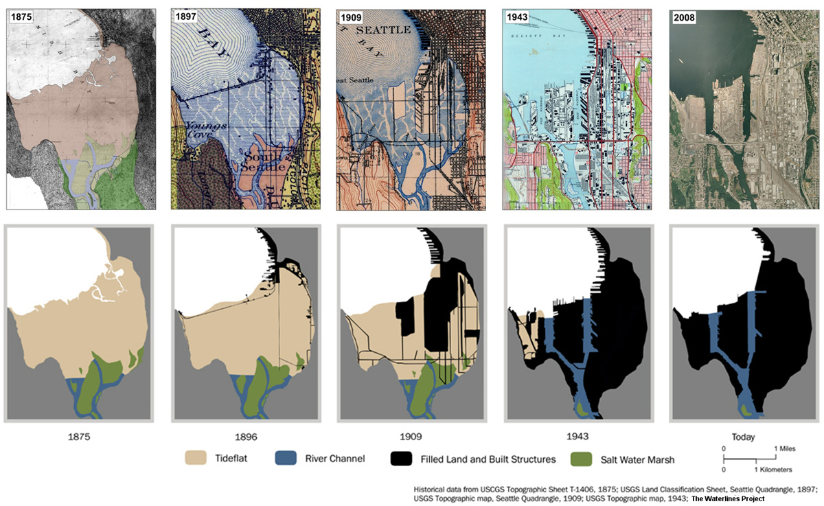
Arguably the greatest transformation the river experienced in recent history was wrought by human engineering. In the early 20th century, a series of major civil engineering projects diverted the comingled flows of three rivers out of the valley, lowered Lake Washington nine feet, shortened the river by four miles, dredged the river into a navigable waterway, filled in the old meanders, and built Harbor Island—the largest manmade island in the world at the time—by washing hillsides into the tide flats. This was largely undertaken for flood control efforts, navigation and commercial interests.
While the pace and scale of the industrialization of the Duwamish valley rivals that of any major city, it also came at a cost. To Coast Salish people, the expansive tidal mud flats and the wetlands adjoining the meandering river were a valuable resource. The channels, islands and shorelines were all populated with names that recorded sacred landscapes, uses, historical memories and meanings.
The engineered changes to Seattle’s shoreline disrupted ecosystems, eliminated traditional food sources (including a productive salmon fishery) and completely reconfigured Coast Salish people's relationship with this place. The land became Seattle’s industrial and commercial heartland and an engine of economic growth for the city. The factories built on top of the old meanders sustained a vibrant economy through two world wars, helping grow Seattle and the Pacific Northwest into what it is today.
The transformed valley continues to provide thousands of jobs. Major efforts are also underway to clean up the river to make the river safe for fish and people alike. The Duwamish Tribe, which plied these waters for millennia, once again have a longhouse along its banks.
